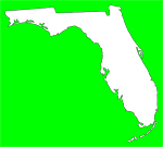
An area of low pressure is expected to develop over the central Gulf of Mexico and move east towards the Florida Peninsula today and then across the central Peninsula early Saturday. Ahead of this system, a large rain shield will spread northeast across much of the state today.
Showers are expected to become heavier and more numerous later today and overnight as the system gets closer to the state and pulls a stalled frontal boundary currently over South Florida northward.
Though severe weather is not anticipated for today, the warm front lifting north tonight and a cold front moving through the area on Saturday could some stronger storms capable of producing frequent lightning, gusty winds and possibly a tornado.
A Flood Watch is in effect for much of West Central Florida through Saturday afternoon and minor flooding of streets, low-lying areas and local rivers and streams is possible statewide over the next 24-36 hours. Residents living in flood prone areas should take action to protect property.
Remember, turn around, don't drown if faced with a flooded roadway.
To access the latest watches, warnings, and advisories from the National Weather Service for your county, please click here.
Subscribe to:
Post Comments (Atom)


No comments:
Post a Comment