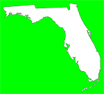
Numerous coastal flood warnings and flash flood watches have been posted for a large area of the northern Florida Gulf Coast from the Panhandle to the Suwannee River, with coastal flood watches in effect south to Tampa Bay. These warnings and watches are in advance of a very strong low pressure system that is currently developing in the western Gulf of Mexico and is forecast to move east towards the Florida Panhandle today and tonight. State emergency management officials are urging residents to closely monitor this system and be prepared to act if conditions warrant.
“This system could present a multi-hazard weather threat that will include heavy rain, tornadoes, coastal flooding and marine hazards across North Florida and the northeastern Gulf of Mexico,” said Acting State Meteorologist Amy Godsey. “Though much of the weather today will be confined to Northwest Florida, a few showers and thunderstorms may develop over the Florida Peninsula north of I-4 and residents need to stay aware of changing conditions into Wednesday.”
The squall line has the potential to produce heavy rain, strong winds and tornadoes as the front moves east. Some areas could receive as much as 2 to 4 inches of rain during the frontal passage with higher totals of 6 to 8 inches possible in 24 hours.
“Now is a good time to review your plans and check that your NOAA Weather Radio has fresh batteries, is turned on and set to alert you of dangerous weather,” added Godsey.
The State EOC in Tallahassee will activate to a Level 2 or Partial Activation with Plans and Operations staff at 1:00 p.m. today to monitor the storm and assist with any requests from county partners.
Subscribe to:
Post Comments (Atom)


No comments:
Post a Comment