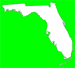
State emergency management officials are urging residents from the Florida Panhandle east through Central Florida to be prepared for possible severe weather beginning Tuesday night into Wednesday as a squall line of storms is forecast to develop ahead of a cold front by mid-week. The National Weather Service’s Storm Prediction Center has placed a large area of North and Central Florida, and the northwestern portion of South Florida at a slight risk for severe weather on Wednesday.
“Residents and visitors in North and Central Florida need to monitor the latest forecasts on this approaching weather system and be prepared to act if additional warnings are issued,” said Acting State Meteorologist Amy Godsey. “A NOAA Weather Radio can be a lifesaver especially during nighttime events.”
This squall line has the potential to produce heavy rain, strong winds and tornadoes late Tuesday night through Wednesday night as the front moves east. Some areas could receive as much as 2 to 4 inches of rain during the frontal passage with higher totals of 6 to 8 inches possible in 24 hours. In addition to the rain, strong southerly winds ahead of the system may also result in coastal flooding along the state’s northern Gulf Coast, where Coastal Flood Watches are now in effect.
“Residents are reminded to respect the power of water and to ‘turn around, don’t drown’ if faced with a flooded roadway,” added Godsey.
Severe weather and tornadoes can occur in any month in Florida. Many of these severe weather outbreaks occur at night during this time of the year. Residents and visitors to the state are urged to monitor this severe weather potential via local media or your local National Weather Service Office, and be sure that the alert settings on your family or business NOAA Weather Radio are turned on.
Subscribe to:
Post Comments (Atom)


No comments:
Post a Comment