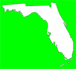
State and local emergency management officials are encouraging residents and visitors in the Florida Panhandle and Florida Big Bend areas to stay alert and exercise caution as a potentially severe storm system moves into the area.
“The NOAA Storm Prediction Center has placed all of the Florida Panhandle and Western Big Bend in an area for an enhanced risk of severe storms on Friday night into Saturday,” said Amy Godsey, State Meteorologist. “This severe weather threat may spread east through Saturday, and we encourage residents and visitors across the region to monitor this weather system and to be prepared to act if warnings are issued.”
This storm system will have the potential to produce large hail, damaging wind gusts and isolated tornadoes. Residents and visitors to the state should monitor local media outlets and ensure that their NOAA All-Hazards Weather Radio alert settings are turned on.
A Tornado Watch means conditions are favorable for tornadoes and severe thunderstorms. A Tornado Warning means a tornado has been reported as sighted, or been picked up on radar in the area.
For more information on the Florida Division of Emergency Management and to GET A PLAN!, please visit: www.FloridaDisaster.org. Follow us on Twitter at www.Twitter.com/flsert.
Subscribe to:
Post Comments (Atom)


No comments:
Post a Comment