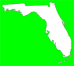
Florida Division of Emergency Management officials are urging residents and visitors in the South Florida region to use extreme caution near local canals and rivers and on area roadways as Tropical Depression 16 is forecast to impact the area today and tomorrow. The system will likely bring the threat for heavy rainfall and flooding and the National Hurricane Center’s Hurricane Hunter aircraft is scheduled to investigate the system this afternoon to determine if a tropical storm has formed. The State Emergency Operations Center is activated to a Level 2 or partial activation to support counties that may be impacted.
“Though this system is unlikely to develop into a hurricane, it is important to remember that a storm doesn’t have to be a hurricane to cause loss of life and devastating property damage,” said David Halstead, Director of the Florida Division of Emergency Management. “It is vital that residents and visitors in South Florida remember the phrase “Turn Around, Don’t Drown” when approaching a flooded roadway and heed all warnings from the National Weather Service and local officials.”
A Tropical Storm Warning has been issued for the Florida coast from Jupiter Inlet south to East Cape Sable and for all of the Florida Keys. A Tropical Storm Warning means that tropical storm conditions are expected somewhere within the warning area within 36 hours. A Tropical Storm Watch has been issued for areas north of Jupiter Inlet to Sebastian Inlet and north of East Cape Sable to Chokoloskee, Florida. A Tropical Storm Watch means that tropical storm conditions are possible within the watch area within 48 hours.
A Flood Watch is in effect until 2 p.m. on Wednesday for Broward, Collier, Miami-Dade, Palm Beach and mainland Monroe counties. A Flood Watch means that there is a potential for flooding based on current forecasts. Residents should monitor forecasts and be alert for possible flooding conditions.
To avoid getting caught in a flood, follow these safety tips:
- A NOAA All-Hazards Weather Radio is one of the best ways to receive warnings from the National Weather Service. Monitor the NOAA Weather Radio or your favorite news source for vital weather-related information.
- If flooding occurs, get to higher ground. Get out of areas subject to flooding, including dips, low spots, canals, ditches, etc.
- Avoid areas already flooded, especially if the water is flowing fast. Do not attempt to cross flowing streams.
- Road beds may be washed out under flood waters. NEVER drive through flooded roadways.
- Do not camp or park your vehicle along streams and washes, particularly during threatening conditions.
- Be especially cautious at night when it is harder to recognize flood dangers.


No comments:
Post a Comment